All Products

NavVis
Germany
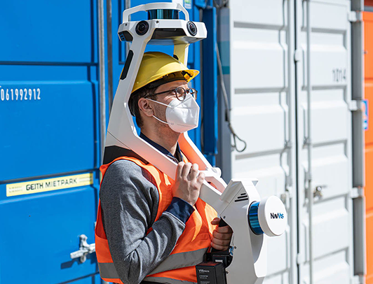
NavVis is a wearable indoor mobile mapping system that enables high-quality reality capture in even the most complex building such as construction sites, staircases and technical rooms.
1. All-in-one – Capture 3D measurements with two multi-layer LiDAR sensors in combination with industry-leading SLAM software to deliver survey-grade point cloud quality. Four cameras positioned on top of the device take high resolution images in every direction for complete 360 capture - all without the operator appearing in the field of view.
2. Live Mapping - Monitor your scanning progress in real time with a built-in touchscreen interface, to ensure complete coverage as you move.
3. Ergonomics - A first-of-its-kind wearable device which enables operators to comfortably scan at the speed of walking. The forward-facing design allows for targeted scanning. together with a built-in screen for optimal viewing.
4. Geo-registration - NavVis VLX is fully compatible with standard tools in the field. It can capture control points in a local site coordinate system measured by Total Stations and GNSS rovers, and also supports national and global coordinates for precise geo-registration and alignment of datasets.